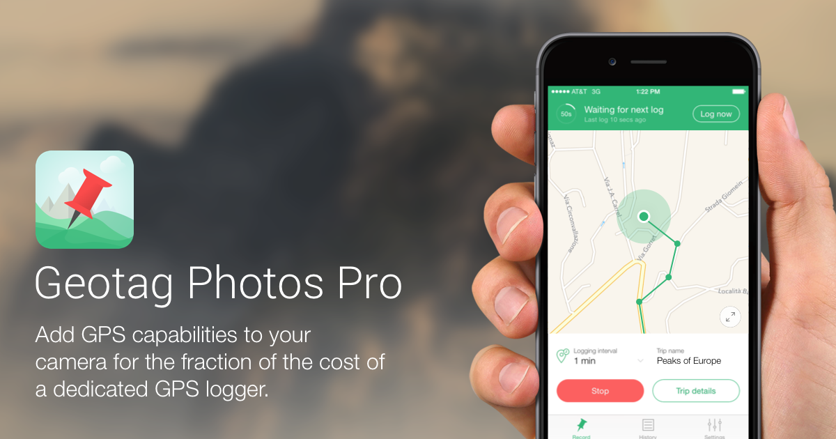
Geotag Photos Pro
Geotagging software
The solution records GPS positions on a mobile device while you shoot, then applies those coordinates to images in a desktop application. It supports JPEG and most RAW formats and can export the logged routes as GPX files through Dropbox, email, or the web, enabling integration with tools such as Lightroom’s Map module. Users can adjust logging interval and accuracy, and the app includes power‑saving mechanisms to extend battery life during all‑day outings.
Compatibility extends to popular smart wearables, allowing recording control from Apple Watch, Android Wear, or Pebble devices. The workflow is designed for both casual outings with a handful of photos and large‑scale trips producing thousands of images, offering a simple, fast process for adding location data to any digital camera’s output.
The software is available for macOS, Windows, Linux, iOS, Android, and iPad, and a free trial can be downloaded from the respective app stores. It targets photographers who need an inexpensive alternative to dedicated GPS loggers while maintaining seamless Lightroom compatibility.
Reviews
Loading reviews…
Similar apps
Photo & Video Management
GeoTag
Geo location editor for images
System Monitoring & Maintenance
GPXSee
GPS log file viewer and analyzer
Travel & Trip Planning
RouteConverter
GPS tool to display, edit, enrich and convert routes, tracks and waypoints
Video Editing
PhotoSync Companion
Transfer and backup photos and videos
Window & Desktop Management
Memory-Map
GPS navigation software
Video Editing
Dashcam Viewer
View videos, GPS data, and G-force data recorded by dashcams and action cams