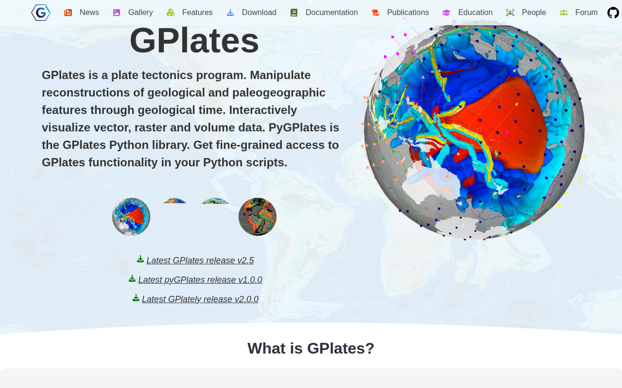
GPlates
Plate tectonics program
The program provides an interactive desktop environment for visualising and manipulating plate‑tectonic reconstructions and associated geological data across deep time. Users can load and display vector, raster and volumetric datasets, adjust plate motions, and explore paleogeographic features through a time‑machine interface. A complementary Python library grants script‑level access to the same functionality, allowing automated reconstruction, analysis of plate kinematics, and integration with other scientific workflows.
The software is aimed at educators, researchers and industry professionals who need to examine the evolution of Earth’s surface, compare multiple plate‑motion models, and generate maps or visualisations of reconstructed data. Its GIS‑like capabilities and support for diverse data types make it suitable for both exploratory analysis and reproducible scientific studies.
Distributed under the GNU GPL v2, the suite runs on Windows, Linux and macOS and includes extensive documentation and open‑access data and models. The ecosystem also includes additional Python packages that extend reconstruction and plotting features, fostering interoperability with other tools.
Reviews
Loading reviews…
Similar apps
Databases & Data Tools
GeoMapApp
Browse, visualise and analyze geoscience data sets
Databases & Data Tools
Panoply netCDF, HDF and GRIB Data Viewer
Plot geo-referenced data from netCDF, HDF, and GRIB

Databases & Data Tools
Grid Analysis and Display System
Access, manipulate, and visualise earth science data
Databases & Data Tools
Gephi
Open-source platform for visualizing and manipulating large graphs
System Monitoring & Maintenance
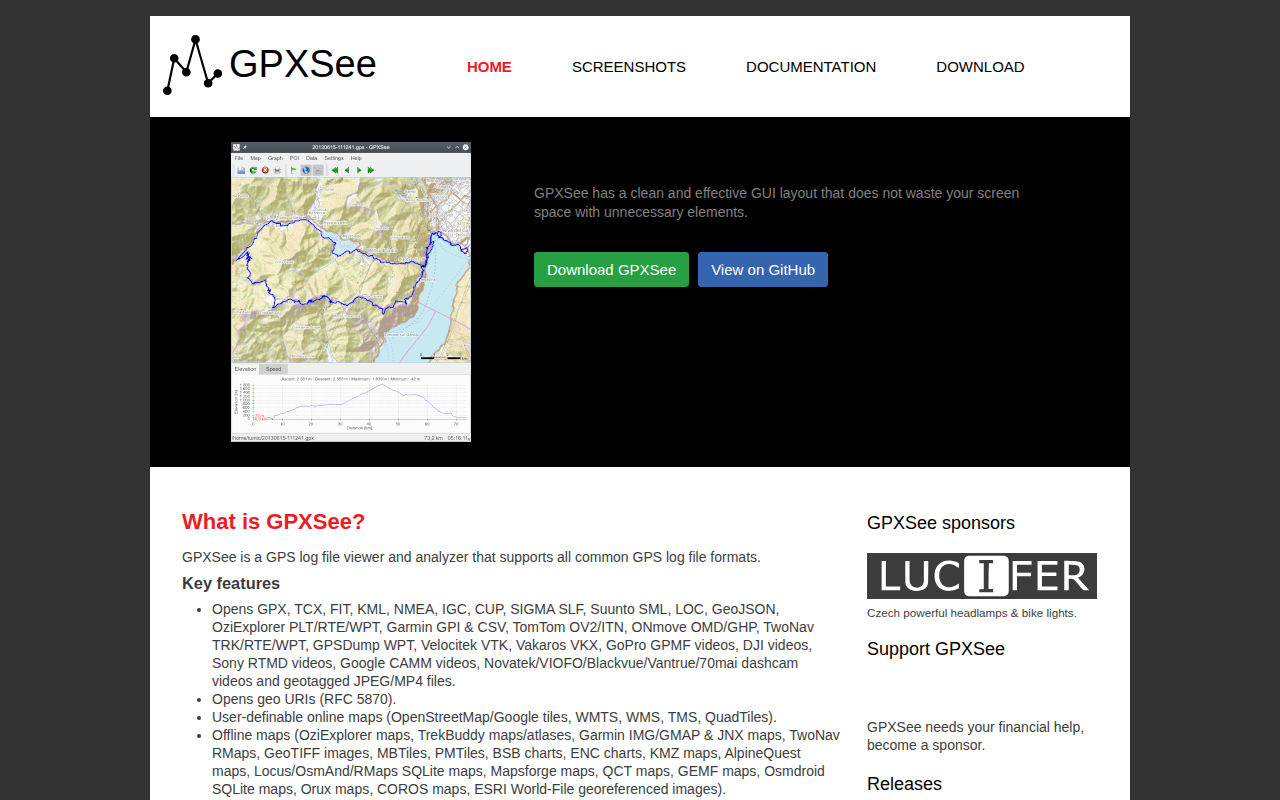
GPXSee
GPS log file viewer and analyzer
Databases & Data Tools
LabPlot
Data visualization and analysis software